You might be thinking 'Where is the Fort William leg'?
I decided to start from Glenfinnan for a number of reasons really. I have done that section many times before in various guises and to be honest I didn't fancy setting off and doing 18 miles on the road. It's purely a matter of personal choice and that was mine. You can make up your own route for that one...
My pack weighed around 18kgs. Whilst I have good gear I don't do strict minimalist as I often feel that the effort of carrying some extra goodies is better for me. I also carried a Hillberg Nallo as I like the extra space.
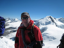
Day one was a good day. Fine weather and a gentle introduction by walking into Glen Finnan past the Corryhully bothy. Sun tan lotion was the order of the day. From the bothy it was a good land rover track more or less up to the top of the Bealach a Chaorainn and from there a steady descent on a path down to the River Pean. The picture was taken at the bealach and naturally I did walk through the gate..
Once over the river you have about 200 metres through boggy forest before you come to the good track. Turn right and walk along the track to the junction and take the left turn up the hill for a few kilometres until you come to the bothy. There is a snall cairn on the right which directs you down to it. The MBA rep who maintains it has installed an impressive water supply nearby. There is also a switch for the immersion which should be turned off when you leave. (If you go you will see)
I was joined around 2030 hours by a nice swiss guy who walked in from Inverie. He had started a couple of days earlier at Shiel Bridge and was walking out to Glenfinnan the next day.
All in all a good introductory day